

Newsroom | 15357 results
Sorted by: Latest
-
Lattice Collaborates with Arm to Advance Secure, Adaptable AI Data Center Infrastructure
HILLSBORO, Ore.--(BUSINESS WIRE)--Lattice Semiconductor (NASDAQ: LSCC), the low power programmable and platform firmware leader, today announced a collaboration with Arm to enable secure control, management, and platform adaptability for AI infrastructure. Combining Arm® AGI CPU server platforms with Lattice FPGAs and AMI firmware creates a solution that provides advanced security, manageability, connectivity, and flexibility for next-generation AI data center infrastructure. In Arm AGI CPU ser...

-
BitRipple LT3 Deployed Across Joby Flight Operations
BERKELEY, Calif.--(BUSINESS WIRE)--BitRipple enables real-time connectivity across satellite and cellular networks for flight-critical telemetry and monitoring in advanced air mobility...

-
Voyager Appoints Patrick Yarborough to Lead Investor Relations
DENVER--(BUSINESS WIRE)--Voyager Technologies (NYSE: VOYG) appointed Patrick Yarborough as vice president, Investor Relations, effective immediately, bringing more than a decade of capital markets, investor communications and corporate development experience to the company. “Growing a public company requires growing the market's trust in it,” said Phil De Sousa, chief financial officer, Voyager. “As we scale our capital base and investor footprint, having someone who has sat on both sides of th...

-
Oscilloquartz expands OSAinside™ Series OSA 5400 TimeCard™ with advanced server-integrated timing capabilities
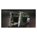
NEUCHÂTEL, Switzerland--(BUSINESS WIRE)--Oscilloquartz today announced significant new capabilities for its OSAinside™ Series OSA 5400 TimeCard™, expanding the flexibility and performance of server-integrated timing for defense, data center, telecom and finance applications. With support for multiple deployment architectures and timing sources, the enhanced OSA 5400 TimeCard™ enables organizations to integrate highly accurate synchronization directly into commercial off-the-shelf (COTS) and pur...
-
Resumen: Exein y Deutsche Telekom IoT se asocian para proteger la próxima generación de dispositivos conectados
ROMA--(BUSINESS WIRE)--Exein, líder mundial en inteligencia artificial física y seguridad en tiempo de ejecución, anunció hoy que ha establecido una alianza estratégica con Deutsche Telekom IoT para brindar seguridad integrada a los dispositivos conectados en todo el ecosistema de Deutsche Telekom IoT. Deutsche Telekom IoT dispone de su propia red transatlántica y alrededor de 600 socios de roaming y satélites, para ofrecer conectividad mundial a sus clientes en diversos sectores y mercados. El...
-
Riassunto: Exein e Deutsche Telekom IoT collaborano per garantire la prossima generazione di dispositivi connessi
ROMA--(BUSINESS WIRE)--Exein, un leader globale nella sicurezza dell'AI fisica e del runtime, oggi ha annunciato una collaborazione strategica con Deutsche Telekom IoT per portare la sicurezza integrata ai dispositivi connessi nell'ecosistema di Deutsche Telekom IoT. Con la sua stessa rete transatlantica e circa 600 partner di roaming e satellitari, Deutsche Telekom IoT offre connettività in tutto il mondo per clienti nei settori e nei mercati. Il testo originale del presente annuncio, redatto...
-
Exein und Deutsche Telekom IoT schließen Partnerschaft, um nächste Generation vernetzter Geräte abzusichern
ROM--(BUSINESS WIRE)--Exein, ein weltweit führendes Unternehmen im Bereich physische KI und Laufzeitsicherheit, gab heute eine strategische Partnerschaft mit Deutsche Telekom IoT bekannt, um integrierte Sicherheit in das Ökosystem der vernetzten Geräte von Deutsche Telekom IoT zu bringen. Mit seinem eigenen transatlantisches Netz und rund 600 Roaming- und Satellitenpartnern bietet Deutsche Telekom IoT weltweite Konnektivität für Kunden aus verschiedensten Branchen und Märkten. Die Partnerschaft...
-
Exein and Deutsche Telekom IoT Partner to Secure the Next Generation of Connected Devices
ROME--(BUSINESS WIRE)--Exein, a global leader in physical AI and runtime security, today announced a strategic partnership with Deutsche Telekom IoT to bring integrated security to connected devices across Deutsche Telekom IoT’s ecosystem. With its own transatlantic network and around 600 roaming and satellite partners, Deutsche Telekom IoT provides worldwide connectivity for customers across industries and markets. The partnership pairs Exein's device-level security with Deutsche Telekom IoT’s...
-
Exein et Deutsche Telekom IoT s’associent pour sécuriser la prochaine génération d’appareils connectés
ROME--(BUSINESS WIRE)--Exein, leader mondial de l’IA physique et de la sécurité d’exécution, a annoncé aujourd’hui un partenariat stratégique avec Deutsche Telekom IoT afin d’apporter une sécurité intégrée aux appareils connectés au sein de l’écosystème de Deutsche Telekom IoT. Grâce à son propre réseau transatlantique et à environ 600 partenaires d’itinérance et de satellites, Deutsche Telekom IoT offre une connectivité mondiale à ses clients, tous secteurs et marchés confondus. Ce partenariat...
-
Samenvatting: Exein en Deutsche Telekom IoT werken samen aan beveiliging van volgende generatie verbonden apparaten
ROME--(BUSINESS WIRE)--Exein, wereldwijd marktleider op het gebied van fysieke AI en runtime-beveiliging, heeft vandaag een strategisch partnerschap aangekondigd met Deutsche Telekom IoT. Het doel is om geïntegreerde beveiliging te bieden voor verbonden apparaten binnen het ecosysteem van Deutsche Telekom IoT. Dankzij een eigen transatlantisch netwerk en ongeveer 600 roaming- en satellietpartners voorziet Deutsche Telekom IoT de klant in uiteenlopende sectoren en markten van wereldwijde connect...